Agriculture has always been a game of decisions. When to sow. Where to plough. How much water is enough. For generations, these decisions were guided by experience, intuition, and a fair amount of guesswork. Today, that guesswork is being replaced by something far more precise. This is where GPS farming enters the picture.
GPS in farming is not just another technology layered onto agriculture. It represents a fundamental shift in how fields are understood, managed, and optimized. Instead of treating an entire farm as one uniform unit, GPS in farming allows farmers to see variability, respond to it intelligently, and make every input count. If you’ve ever wondered how high-tech agriculture actually works on the ground, this guide will walk you through it step by step.
What is GPS in farming and how does it work in agriculture?
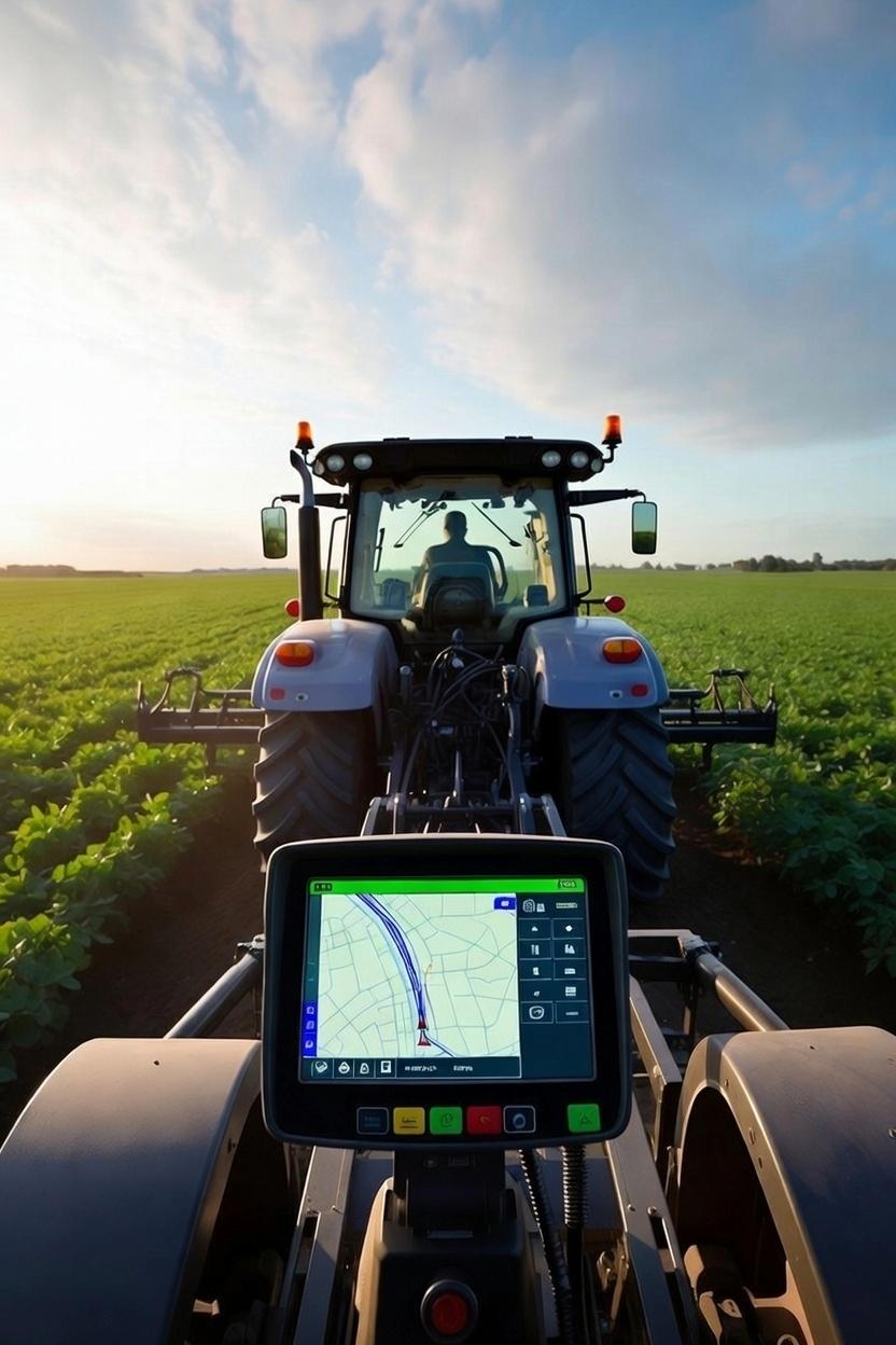
At its core, GPS farming uses satellite-based positioning systems to determine the exact location of farm equipment and field activities. These satellites transmit signals to GPS receivers mounted on tractors, sprayers, harvesters, or handheld devices. The receiver calculates its position with remarkable accuracy, often within a few centimeters when using advanced correction systems.
Why does this matter? Because once location becomes precise, farming becomes measurable. Every pass of a tractor, every spray operation, every seed placed in the soil can be tracked, recorded, and repeated with consistency. Farming with GPS transforms fields into digital maps where each section has its own identity, history, and requirements.
This location intelligence becomes the foundation for everything that follows, from precision agriculture practices to variable rate application and yield analysis.
Why is GPS in farming essential for high tech agriculture today?
Modern agriculture operates under pressure. Input costs are rising. Climate patterns are becoming less predictable. Labor availability is shrinking. At the same time, farmers are expected to produce more, waste less, and operate sustainably.
Farming with GPS addresses these challenges by replacing blanket decisions with data-driven ones. Instead of applying the same treatment everywhere, farmers can adjust actions based on what each part of the field actually needs. According to the research, precision agriculture technologies can significantly reduce input use while maintaining or even improving yields when applied correctly. High-tech agriculture is not about complexity for its own sake. It’s about control, predictability, and efficiency, and farming with GPS is what makes those qualities possible in real-world farming conditions.
How does GPS in farming enable precision agriculture practices?
Precision agriculture is often spoken about as a broad concept, but GPS farming is the tool that makes it practical. By geo-referencing fields, farmers can layer different types of information onto the same map. Soil variability, nutrient levels, moisture zones, crop health data, and yield outcomes all begin to tell a story when viewed through a GPS-enabled system.
For example, a low-yield patch in a field is no longer a mystery. GPS data allows that exact zone to be analyzed for soil compaction, nutrient deficiency, or drainage issues. Over time, these insights help farmers move from reactive problem-solving to proactive planning.
This shift from uniform management to site-specific management is the defining feature of precision agriculture, and using GPS in farming is what anchors it in reality.
What role does GPS farming play in variable rate application?
Variable rate application is where farming with GPS truly proves its value. Instead of applying seeds, fertilizers, or chemicals at a single rate across an entire field, variable rate systems adjust application levels in real time based on location-specific data.
Here’s how it works. Field maps created through GPS based farming identify zones with different productivity levels or nutrient needs. These maps are uploaded into application equipment equipped with GPS receivers and controllers. As the equipment moves through the field, it automatically adjusts application rates based on its exact position.
The result is smarter input use. Fertilizer is applied where it’s needed most and reduced where it isn’t. Seeds are placed at densities suited to soil potential. Crop protection products are used more efficiently. Studies from institutions like Iowa State University have shown that variable rate fertilization can significantly improve nutrient use efficiency while reducing environmental losses.
Farming with GPS is what makes this precision possible, turning static field plans into dynamic, responsive operations.
How is GPS in farming used across different farm operations?
GPS farming does not belong to one stage of agriculture. It supports decision-making throughout the entire crop cycle.
During land preparation, GPS-guided equipment ensures straight passes and minimizes overlap, reducing fuel use and soil compaction. At planting, GPS systems help maintain consistent row spacing and precise seed placement, which directly impacts crop emergence and uniformity.
During spraying and fertilization, farming with GPS enables section control, preventing double application and missed areas. At harvest, yield monitors linked with GPS create detailed yield maps that reveal performance patterns across the field.
Each operation builds on the previous one, creating a continuous feedback loop. Over time, this data becomes a powerful asset, helping farmers refine strategies season after season.
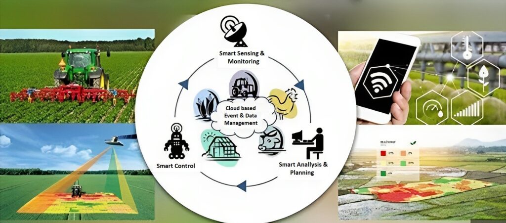
What technologies work alongside GPS in farming systems?
GPS farming rarely operates in isolation. Its true strength emerges when combined with other agricultural technologies. Soil sensors provide real-time data on moisture and nutrient availability. Drones and satellite imagery offer aerial perspectives on crop health and stress patterns. Farm management software integrates GPS data into dashboards that support planning, reporting, and compliance.
Together, these tools form an ecosystem where decisions are no longer fragmented. Instead, information flows seamlessly from field to system to strategy. This integrated approach is increasingly adopted by agri-businesses focused on scalability and traceability.
Companies like Invade Agro Global actively work at this intersection of agronomy and technology, helping bridge the gap between advanced tools and practical farm execution.
What are the key benefits of farming with GPS for farmers and agribusinesses?
The benefits of farming with GPS extend well beyond yield improvements. One of the most immediate advantages is cost efficiency. By reducing overlaps and unnecessary input use, farmers often see measurable savings in fuel, seed, and chemicals.
There is also a strong sustainability dimension. Precise input placement reduces nutrient runoff and chemical drift, supporting better environmental outcomes. From a business perspective, farming with GPS improves traceability and documentation, which is increasingly important for compliance, certifications, and export markets.
Perhaps most importantly, optimizing GPS in farming gives farmers confidence. Decisions are backed by data rather than assumptions, making outcomes more predictable and less stressful in an already uncertain industry.
What should farmers consider before adopting GPS technology in farming?
While farming with GPS offers clear advantages, successful adoption requires thoughtful planning. Equipment compatibility, data accuracy, and operator training all matter. GPS systems are only as effective as the data guiding them, which means farmers must invest time in understanding maps and recommendations rather than treating technology as a plug-and-play solution.
It’s also important to view GPS in farming as a long-term investment. Returns often compound over multiple seasons as historical data builds and strategies are refined. Starting with a focused application such as guidance systems or basic mapping is often a practical way to begin.
How GPS technology in farming is shaping the next era of agriculture
GPS in agriculture represents more than technological progress. It signals a mindset shift. Agriculture is moving from intuition-led decisions to insight-driven systems. From uniform fields to variable landscapes. From reactive responses to planned precision.
As pressures on agriculture continue to rise, the farms that thrive will be those that understand their fields deeply and manage them intelligently. GPS in farming provides that understanding. It turns land into data, data into decisions, and decisions into resilience.
The next era of agriculture is not defined by bigger machines or heavier inputs. It is defined by accuracy. And GPS farming is where that accuracy begins.